-
Please take a moment and update your account profile. If you have an updated account profile with basic information on why you are on Air Warriors it will help other people respond to your posts. How do you update your profile you ask?
Go here:
Edit Account Details and Profile
You are using an out of date browser. It may not display this or other websites correctly.
You should upgrade or use an alternative browser.
You should upgrade or use an alternative browser.
Random Griz Aviation Musings
- Thread starter Griz882
- Start date
ALERT! ALERT! ALERT! This is a warning to the people of Pagistan. If you do not immediately demand the Pagistanian Peoples Infrastructure Committee fix your tragically named “Indian Head Highway” the Yankee Sky Pirates will begin immediate low-level attacks! We have a training guide....

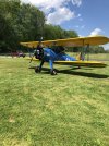
Went for an afternoon flight...lots of turbulence for our first warm day. Out local Stearman guy had his airplane out.
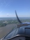
It was too bumpy for any good photos but if you look at the horizon on this image that eyeball burning bright light is the US Capital Dome. It gives me new respect for the guys who fly the Mount Vernon approach to DCA! They must all have spots burned into their vision.

Went for an afternoon flight...lots of turbulence for our first warm day. Out local Stearman guy had his airplane out.

It was too bumpy for any good photos but if you look at the horizon on this image that eyeball burning bright light is the US Capital Dome. It gives me new respect for the guys who fly the Mount Vernon approach to DCA! They must all have spots burned into their vision.

Much better day for flying today. Headed out to KOXB, Ocean City. Here is a few of the board walk on my take-off.

I flew over the home of some lucky fellow that has his own airstrip pretty much on his own island on the Bay. Really close to Pax River, but a nice way to live.
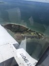
I saw two Navy helos heading south right down the middle of the bay but wasn’t able to get a picture. Instead I have this nice shot of the bay looking north.
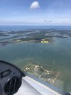

I flew over the home of some lucky fellow that has his own airstrip pretty much on his own island on the Bay. Really close to Pax River, but a nice way to live.

I saw two Navy helos heading south right down the middle of the bay but wasn’t able to get a picture. Instead I have this nice shot of the bay looking north.

I flew over the home of some lucky fellow that has his own airstrip pretty much on his own island on the Bay. Really close to Pax River, but a nice way to live.
Any chance you can give a Lat/Long for that? There's lots of reasons why that life would be annoying (see: grocery shopping), but knowing distance and factoring in giving yourself your own Special Use GPS approach, it could be a neat life.
It’s called Ragged Island. Lat/Lon is middle/nowhere...?. Actually it is 38.54N/76.28W and the airport identification is MD82. It is clear you would have to have a boat, helicopter, and an extra car at a place near DC or Easton MD. That way you could fly to your groceries.
I am a purely VFR guy with occasional forays into Special VFR and VFR over the top (when needed). I have an iLevil 3AW WAAS that provides navigation and ADS-B “In” displayed on a panel mounted iPad. I also carry a Bad Elf WAAS GPS as a backup. The Garmin G5 allows me VOR capability in case things get really crappy, but that is mostly a backup. I recently shifted from WingX to ForeFlight mostly for the logbook and checklist functionality but I have only started to understand the capability of the program. I have practiced a few unofficial IFR (on clear days) approaches using what I have and it brings you in amazingly well. I am thinking about dumping the iLevil for a Sentry as the iLevil has no online system for updating the firmware.@Griz882 what GNS/Navigator do you have installed - (just curious) ?
I bought 5 Sentry devices for my owners - and its a great device and gets better over time precisely because of the firmware update capability. Highly recommended.I am a purely VFR guy with occasional forays into Special VFR and VFR over the top (when needed). I have an iLevil 3AW WAAS that provides navigation and ADS-B “In” displayed on a panel mounted iPad. I also carry a Bad Elf WAAS GPS as a backup. The Garmin G5 allows me VOR capability in case things get really crappy, but that is mostly a backup. I recently shifted from WingX to ForeFlight mostly for the logbook and checklist functionality but I have only started to understand the capability of the program. I have practiced a few unofficial IFR (on clear days) approaches using what I have and it brings you in amazingly well. I am thinking about dumping the iLevil for a Sentry as the iLevil has no online system for updating the firmware.
Foreflight Basic @ $100/year is the way to go IMHO.
The Physics Toolbox app, running on IOS and Android, is worth having around. Excellent accelerometer, inclinometer, turn rate, speed, and other stuff from your phone’s sensors. Variable sampling rate. Can save time history to a data file for post flight analysis. Maybe to build out some performance charts for your plane?
And it’s free!
And it’s free!
Agree with ForeFlight...it has some solid chops. I will probably drop the buck for a Sentry.I bought 5 Sentry devices for my owners - and its a great device and gets better over time precisely because of the firmware update capability. Highly recommended.
Foreflight Basic @ $100/year is the way to go IMHO.
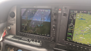
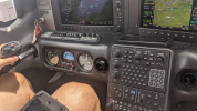
Giving instrument instruction to a new client in his SR-22 - dodging CB buildups and occasional heavy precip. I have to say for $400K of an airplane I am not impressed. Its still a 150kt ride at reasonable power/FF. My client is a well off tech entrepreneur who relies on the automation (and it is very good) but he was uncomfortable hand flying. He genuinely relies on the last-ditch "CAPS" parachute - and can't blame him that's how the factory trained him to fly it. But man... Interesting.
Cirrus is a closed ecosystem that makes Apple seem like open-source. Cirrus is great at extracting as much recurring passive revenue from owners as they can.
For the well-heeled, great.
Cirrus is a closed ecosystem that makes Apple seem like open-source. Cirrus is great at extracting as much recurring passive revenue from owners as they can.
For the well-heeled, great.


G1000, yes.Garmin?


