• Please take a moment and update your account profile. If you have an updated account profile with basic information on why you are on Air Warriors it will help other people respond to your posts. How do you update your profile you ask?

    Go here:

    Edit Account Details and Profile

Current SNA at Kingsville - Send Questions

Swanee

Cereal Killer
pilot
None
Contributor
It would be easier for an adversary to degrade our nav satellites than disabling our ground-based VORTACs.

It's not really in anyone's interest to go blowing a bunch of stuff up in orbit. The debris stays up there, and basically turns into a big shotgun blast for anything in the general area of the blown-up vehicle. It's projected that it's possible to have a cascading effect, whereby huge ranges of potential orbits get denied for decades or more.


It's also interesting to get into the right spaces to read and discuss who is using our satellites for what and why.

If you're going to turn the lights off in a room before a fight, you better have the ability to see in the dark.
 

Gatordev

Well-Known Member
pilot
Site Admin
Contributor
I have heard and seen the FAA plans to decommission an increasing number of TACANs and replace them with RNAV waypoints (like the BFM TACAN just being a named RNAV waypoint like BRKLY or something), so it makes sense that Big Navy would want to increasingly rely on RNAV for enroute navigation and for instrument approaches.

Nit already described how modern INS systems work, but looking at the bigger picture, keep in mind the various systems don't all have the same legal capabilities. Also "RNAV" doesn't just mean GPS, but is a much broader term for Area Navigation. This can include:

  • RNAV (yeah, I know, it's confusing, but it's a separate technology not really used much anymore)
  • GPS only
  • INS
  • AHRS coupled with GPS
  • FMS

Just because you have an insanely accurate INS and a technically accurate GPS doesn't mean it's certified to conduct RNAV functions (like approaches or DIRECT TO nav), or if it can do those things, it may be limited to what kind of function (like a GPS non-precision approach versus a GPS precision approach).

The Navy has been severely behind compared to where the U.S. NAS has been headed, including federally required technology (ADS-B). There's good and not so good reasons for that, which include funding and a legacy understanding of how the world actually works compared to 20 years earlier. But it is what it is.
 
Thanks for the humble pie, everyone. But, since we're on the topic, I have a legitimate question about this because I've heard different things from different people: does the T-45 have a GPS? I've been told it does not. I've been told "ehhh kinda." A sim instructor at CTW-6 was the only one to give me the most complete answer (which I think is correct): It has an INS where the jet's position information is regularly updated by a GPS receiver to minimize error in the INS. Without the GPS, the INS would nonetheless function just fine (with more error, of course).

I think some of the other points were very interesting, so I'm not trying to fly direct to DOUCH - I do apologize for coming off that way. I have heard and seen the FAA plans to decommission an increasing number of TACANs and replace them with RNAV waypoints (like the BFM TACAN just being a named RNAV waypoint like BRKLY or something), so it makes sense that Big Navy would want to increasingly rely on RNAV for enroute navigation and for instrument approaches. But tactically, is this the most sound decision to decommission the ground-based NAVAIDs? It would be easier for an adversary to degrade our nav satellites than disabling our ground-based VORTACs. I understand we're not getting rid of all of them, but I still think it's a bit shortsighted. I like RNAV navigation as much as anyone- it's far easier and more accurate, for instance, to proceed direct using GPS than doing a point-to-point, but I think (and it may be my ignorance, so grain of salt) it's tactically unsound to just decommission a bunch of TACANs and just rely increasingly on satellite-based navigation.
It does have GPS. Its a part of GINA. It is just not RNAV capable.
 

wlawr005

Well-Known Member
pilot
Contributor
Thanks for the humble pie, everyone. But, since we're on the topic, I have a legitimate question about this because I've heard different things from different people: does the T-45 have a GPS? I've been told it does not. I've been told "ehhh kinda." A sim instructor at CTW-6 was the only one to give me the most complete answer (which I think is correct): It has an INS where the jet's position information is regularly updated by a GPS receiver to minimize error in the INS. Without the GPS, the INS would nonetheless function just fine (with more error, of course).

I think some of the other points were very interesting, so I'm not trying to fly direct to DOUCH - I do apologize for coming off that way. I have heard and seen the FAA plans to decommission an increasing number of TACANs and replace them with RNAV waypoints (like the BFM TACAN just being a named RNAV waypoint like BRKLY or something), so it makes sense that Big Navy would want to increasingly rely on RNAV for enroute navigation and for instrument approaches. But tactically, is this the most sound decision to decommission the ground-based NAVAIDs? It would be easier for an adversary to degrade our nav satellites than disabling our ground-based VORTACs. I understand we're not getting rid of all of them, but I still think it's a bit shortsighted. I like RNAV navigation as much as anyone- it's far easier and more accurate, for instance, to proceed direct using GPS than doing a point-to-point, but I think (and it may be my ignorance, so grain of salt) it's tactically unsound to just decommission a bunch of TACANs and just rely increasingly on satellite-based navigation.
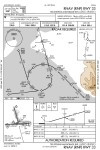
The simplest answer I tell students is the T45 is certified by the FAA to navigate with a tacan needle and a chart. It also has VOR/ILS. Everything else is fluff, technique, and workarounds.

There is a minimum list of operational VOR/TAC stations required in the national airspace system. You have to remember, aside from GPS waypoints and Q routes, every Victor airway and Jet route is defined by a VORTAC type station.
 

nittany03

Recovering NFO. Herder of Programmers.
pilot
None
Super Moderator
Contributor
The simplest answer I tell students is the T45 is certified by the FAA to navigate with a tacan needle and a chart. It also has VOR/ILS. Everything else is fluff, technique, and workarounds.

There is a minimum list of operational VOR/TAC stations required in the national airspace system. You have to remember, aside from GPS waypoints and Q routes, every Victor airway and Jet route is defined by a VORTAC type station.
And to operate beyond those capes, you need a database of existing NAVAIDs, airfields, and intersections, as well as the certified ability to type them into the flight plan by name, without fiddle-farting around with lat-longs. As an example, the Prowler had a commercial nav unit whereby if we were coming home and cleared direct BOCAT direct KNUW, we could just clear out DARIN from the flight plan and add BOCAT.

And you need more beyond that to shoot GPS approaches, because there's additional functionality regarding lateral limits in different segments of the approach, when to autosequence to a new waypoint (or not), and so forth.
 

PMPT

Well-Known Member
Better than the GINA in the T-45? I think the GINA is significantly better than the T-6 FMS.

This is a most surprising statement. I have to ask though - it says on your bio you were at VT-86? The T-6B has much better avionics than the T-6A you would have seen during your primary phase.
 

Flash

SEVAL/ECMO
None
Super Moderator
Contributor
It's not really in anyone's interest to go blowing a bunch of stuff up in orbit. The debris stays up there, and basically turns into a big shotgun blast for anything in the general area of the blown-up vehicle. It's projected that it's possible to have a cascading effect, whereby huge ranges of potential orbits get denied for decades or more.

Yet several countries have done just that, demonstrating that some folks (political and military leadership) might dismiss the concerns of the experts for 'short-term' gain if the shooting starts. It is just a theory so why not try and see?! The bonus is Sandra Bullock still survives, even if she was in the wrong orbit.
 

no_rex4u

I hope you like jammin too.
But, looking back on pri and intermediate, I think that the Navy wastes a lot of money with the GPS in every T-6. The studs going jets are not going to have a GPS in their cockpit. I've been told aircraft in the Navy with a GPS is a minority, so why waste so much time learning something you won't use in the fleet.
This is simply not true,

F-18s are RNAV capable, and we shoot RNAV approaches quite frequently. Exped growlers are also ILS capable
 

MIDNJAC

is clara ship
pilot
This is simply not true,

F-18s are RNAV capable, and we shoot RNAV approaches quite frequently. Exped growlers are also ILS capable

I think this is coming from the fact that until a couple-three short years ago when the fleet actually got RNAV, this statement was true (VAQ-exped Narnia civ ILS notwithstanding). There are non-JO VT(J) IP's who have been out of grey jets long enough to possibly not even know this. I went the first 10 years of my active career without ever flying an RNAV or otherwise GPS based approach. But as you mention, no longer is this the case.
 

Python

Well-Known Member
pilot
Contributor
This is simply not true,

F-18s are RNAV capable, and we shoot RNAV approaches quite frequently. Exped growlers are also ILS capable

And in full transparency, F18 RNAV (which is relatively new) is not “complete.” Numerous approaches are filtered out, as are many RNAV SIDs and STARs. The F18 can simply not do those procedures, and the RNAV system is very limited in the RNAV leg types than can be flown compared to other RNAV aircraft.
 

no_rex4u

I hope you like jammin too.
I think this is coming from the fact that until a couple-three short years ago when the fleet actually got RNAV, this statement was true (VAQ-exped Narnia civ ILS notwithstanding). There are non-JO VT(J) IP's who have been out of grey jets long enough to possibly not even know this. I went the first 10 years of my active career without ever flying an RNAV or otherwise GPS based approach. But as you mention, no longer is this the case.
And in full transparency, F18 RNAV (which is relatively new) is not “complete.” Numerous approaches are filtered out, as are many RNAV SIDs and STARs. The F18 can simply not do those procedures, and the RNAV system is very limited in the RNAV leg types than can be flown compared to other RNAV aircraft.
that is true. RNAV worked great in Japan and korea.
The few issues i have had, were mainly with STARs Sids, and a few approaches.

Overall, i like it.
 

ChuckMK23

FERS and TSP contributor!
pilot
The march to decom VOR's continues - and if the FAA had its way, ILS would be further displaced by precision approach classified RNAV with LPV mins. It seems air carriers are pushing back on training costs and hardware implementation - and the FAA is further pushing back with government funding and dedicated individualized air carrier programs to cross the chasm so to speak. Horizon and Alaska Airlines are doing some pretty wild RNP RNAV procedures up in Alaska (maybe UPS too?)

30257
 

Gatordev

Well-Known Member
pilot
Site Admin
Contributor
...and if the FAA had its way, ILS would be further displaced by precision approach classified RNAV with LPV mins.

For that to happen, they'd also have to rewrite the FARs for alternates. Having an available Class 1 navaid is still a requirement.

That said, I can understand the pushback. I've now reverted to DR/LOI mode twice on cross-countries. Recently while going by Eglin and another time going by White Sands. Having something as a backup seems smart for now. The sheer amount of GPS testing seems to knock the system out daily across a large swath of the country.
 

Gatordev

Well-Known Member
pilot
Site Admin
Contributor
Yes and GBAS makes it Class 1 - and I think its on the National Airspace System roadmap.

So I skimmed the FAA's page on GBAS which probably means I missed something, but...some questions that maybe you have more info on. Does the overall GBAS system require another receiver beyond what's already installed (WAAS and ILS)? I wasn't really clear on that given that it merges signals, but seems to also send correction signals via VHF (and does the GPS need a software update to integrate the signal?). And wouldn't GBAS still require a GPS signal? Jamming isn't going to help with that, and if it uses available ILS hardware, then why not just use the ILS (which may or may not be at a given airport)?

GBAS seems like a more robust and useful version of WAAS, but I'm not convinced (due to my ignorance, no doubt) it's "as robust" as a dedicated ILS in a (self-induced) denied environment, which obviously isn't a long-term solution.
 
Top