• Please take a moment and update your account profile. If you have an updated account profile with basic information on why you are on Air Warriors it will help other people respond to your posts. How do you update your profile you ask?

    Go here:

    Edit Account Details and Profile

Airspace and Chart geekery

Gatordev

Well-Known Member
pilot
Site Admin
Contributor
Here's a question for those inclined to go play on Skyvector or with Foreflight (and the like). I'm guessing @HAL Pilot may answer this quickly since he worked there.

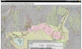
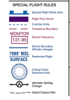
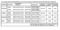
If you go to the Grand Canyon SFRA chart and look at the "Flight Free Zones," you'll see the corridors in between them. In those corridors, you'll see two dotted blue lines connecting each Zone with the adjacent zone. The dotted line looks just like a Class D boundary. So what are those dotted lines supposed to represent? They don't appear to be related to the GCN Class D (and why would they?), so I can't figure out what they mean. The Chart User's Guide was no help.

Bonus question, what does the blue circle at Point Imperial (North Rim) represent? It's not labeled as either a Prohibited or Restricted Area. Not sure if it's in Part 93 (haven't read that yet).
 

Griz882

Frightening children with the Griz-O-Copter!
pilot
Contributor
I know the answer!

The blue hash marks indicate where GA flights have to remain above a certain altitude in the corridor while tour operators have to remain below. The area around Point Imperial Is the North Rim overlook, so no planes allowed to keep it quiet for the tourists. The actual answer is on the back of the paper chart Grand Canyon.
 

Gatordev

Well-Known Member
pilot
Site Admin
Contributor
I know the answer!

The blue hash marks indicate where GA flights have to remain above a certain altitude in the corridor while tour operators have to remain below. The area around Point Imperial Is the North Rim overlook, so no planes allowed to keep it quiet for the tourists. The actual answer is on the back of the paper chart Grand Canyon.

Ah, okay. There's the note about north/south course rules, but I didn't put it together with the lines. Thanks.

I forgot I could pull up the legend in FF. I'm guessing that would have saved me the time.
 

Griz882

Frightening children with the Griz-O-Copter!
pilot
Contributor
Ah, okay. There's the note about north/south course rules, but I didn't put it together with the lines. Thanks.

I forgot I could pull up the legend in FF. I'm guessing that would have saved me the time.
You can pull up the legend on ForeFlight? Now I didn’t know that...I just touch the airspace and look it up!
 

HAL Pilot

Well-Known Member
None
Contributor
What @Griz882 said.

Thanks Griz for saving me from having to try and find the penguins that already fell off the iceberg years ago.

We never looked at the chart. We had 7 or 8 standard tour routes and their altitudes memorized by landmarks and flew those when VFR. We also had sector min and max altitudes memorized. In training once a year we went over the chart and then promptly folded them away into our flight bags until the next year.
 

Griz882

Frightening children with the Griz-O-Copter!
pilot
Contributor
I only know because I used to work for the NPS and knew the guys in aviation who worked this stuff with the FAA.
 

Gatordev

Well-Known Member
pilot
Site Admin
Contributor
We never looked at the chart. We had 7 or 8 standard tour routes and their altitudes memorized by landmarks and flew those when VFR.

And why would you? Your employer paid the monies so you didn't have to worry about it.

You can pull up the legend on ForeFlight? Now I didn’t know that...I just touch the airspace and look it up!

In "MAP Mode," select the gear at the top. Scroll down, and select "Map touch action." You can set it to display the legend. I didn't check if the SFRA legend came up (but I'll look). But the Las Vegas legend will come up when zoomed out.

Ready room down for @Gatordev. See you in khakis for remedial SDO tomorrow! ?

AA for pre-flight planning, BA for SA and not using all resources available. Net Average event.
 

ChuckMK23

FERS and TSP contributor!
pilot
BTW most charts are downloadable for public use - free of charge from faa.gov - e.g. VFR charts are here

A free/basic chart viewer app - that allows basic search and indexing is coming from FAA for both iOS and Android. Not geo-referenced like Foreflight, Flt Deck Pro, Sky Vector - and simply replaces the paper chart you would otherwise purchase. I also understand DoD is about to release something similar for Android.
 

Gatordev

Well-Known Member
pilot
Site Admin
Contributor
More geekery...

I haven't flown a STAR in...a bit, and I don't know that I've ever flown a RNAV STAR, so trying to make sure I'm understanding what the depiction is saying. I'm planning on going into the DFW Class B, so I'll use the TRUUK TWO Arrival as an example, found here.

First, the AIM says:

Standard Terminal Arrival (STAR) Procedures
  1. A STAR is an ATC coded IFR arrival route established for application to arriving IFR aircraft destined for certain airports. STARs simplify clearance delivery procedures, and also facilitate transition between en route and instrument approach procedures.
    1. STAR procedures may have mandatory speeds and/or crossing altitudes published. Other STARs may have planning information depicted to inform pilots what clearances or restrictions to “expect.” “Expect” altitudes/speeds are not considered STAR procedures crossing restrictions unless verbally issued by ATC. Published speed restrictions are independent of altitude restrictions and are mandatory unless modified by ATC. Pilots should plan to cross waypoints with a published speed restriction, at the published speed, and should not exceed this speed past the associated waypoint unless authorized by ATC or a published note to do so.
      NOTE-

      The “expect” altitudes/speeds are published so that pilots may have the information for planning purposes. These altitudes/speeds must not be used in the event of lost communications unless ATC has specifically advised the pilot to expect these altitudes/speeds as part of a further clearance.

      REFERENCE-

      14 CFR Section 91.185(c)(2)(iii).
    2. Pilots navigating on, or navigating a published route inbound to, a STAR procedure must maintain last assigned altitude until receiving authorization to descend so as to comply with all published/issued restrictions. This authorization will contain the phraseology “DESCEND VIA.” If vectored or cleared to deviate off a STAR, pilots must consider the STAR canceled, unless the controller adds “expect to resume STAR”; pilots should then be prepared to rejoin the STAR at a subsequent fix or procedure leg. If a descent clearance has been received that included a crossing restriction, pilots should expect the controller to issue an altitude to maintain. If the STAR contains published altitude and/or speed restrictions, those restrictions are canceled and pilots will receive an altitude to maintain and, if necessary, a speed.
      1. Clearance to “descend via” authorizes pilots to:
        1. Descend at pilot's discretion to meet published restrictions and laterally navigate on a STAR.
        2. When cleared to a waypoint depicted on a STAR, to descend from a previously assigned altitude at pilot's discretion to the altitude depicted at that waypoint.
        3. Once established on the depicted arrival, to descend and to meet all published or assigned altitude and/or speed restrictions.
          NOTE-
          1. When otherwise cleared along a route or procedure that contains published speed restrictions, the pilot must comply with those speed restrictions independent of any descend via clearance.
          2. ATC anticipates pilots will begin adjusting speed the minimum distance necessary prior to a published speed restriction so as to cross the waypoint/fix at the published speed. Once at the published speed, ATC expects pilots will maintain the published speed until additional adjustment is required to comply with further published or ATC assigned speed restrictions or as required to ensure compliance with 14 CFR Section 91.117.
          3. The “descend via” is used in conjunction with STARs to reduce phraseology by not requiring the controller to restate the altitude at the next waypoint/fix to which the pilot has been cleared.
          4. Air traffic will assign an altitude to cross the waypoint/ fix, if no altitude is depicted at the waypoint/fix, for aircraft on a direct routing to a STAR. Air traffic must ensure obstacle clearance when issuing a “descend via” instruction to the pilot.
          5. Minimum en route altitudes (MEA) are not considered restrictions; however, pilots must remain above all MEAs, unless receiving an ATC instruction to descend below the MEA.

Specifically note NOTE 5 in the AIM blurbage. On the TRUUK TWO.RRONY, there are MEAs, but there's also a MOCA, so not sure what the MEA is providing other than comms, but it's not like it's crazy far out.

So, my question is: there is only one altitude restriction at SASIE, unlike a lot of STARS which have restrictions at each waypoint. So if coming from RRONY, do I have to stay at 10,000 until CAINE? Losing 4K' in 16 miles is very doable, but still not clear on what the MEA is providing since it's a RNAV.

Attaching the STAR as well, for those that can't follow the link.
 

Attachments

  • 06918TRUUK.PDF
    224.6 KB · Views: 10

Jim123

DD-214 in hand and I'm gonna party like it's 1998
pilot
You do have to maintain at least 10,000 until CAINE, on the segment between RRONY and CAINE, unless they tell you something different. After CAINE, you don't necessarily have to descend though, it depends-

Those attitudes at SASIE say "expect" and that makes them be not restrictions, not in the regulatory definition of the word restriction. The altitudes annotated on there are only there so you can do some quick pilot math... no, really, that's all it is. If ATC doesn't mention altitude at SASIE then pretend nothing is written on the plate; if they've said the magic words "descend via" without assigning you a hard altitude then this is actually a pretty nice arrival- since there aren't any published top altitudes then your vertical profile can resemble a descend at pilot's discretion profile.

Until they tell you otherwise (and they will...), you're free to stay high for as long as you please. Just don't go below any of those segment MEAs until you're cleared lower!

As you mentioned, the descent profile from CAINE to 5-6k at SASIE passes the sniff test (around 300' per mile/1000' per 3 miles, which is perfectly normal).


What may very well happen happen is they'll have you skip RRONY by clearing you direct to CAINE, and all in the same call telling you to "descend to 5,000 (or 6,000)" as well as "descend via the TRUUK."

If they want you to do the descend via but they also want you to maintain some exact altitude along the arrival, then that is the case when they say "descend via the TRUUK, except maintain _." Or if they already told you descend via but then they decide they want an altitude, then it's just "descend and maintain __" or "maintain __" as the case may be.

This is one of those "descend via" cases where they'll most likely assign an altitude for a couple of reasons: first, the published altitude at SASIE is only an "expect" and there are only minimum altitudes (but no crossing restrictions nor segment restrictions, just MEAs), so in a practical sense, sooner or later they need to give you some altitude, second, if DFW and DAL are on the south flow/landing to the south then ATC needs to get you under the arrivals coming from the northwest (you're coming from the northeast). That airline traffic flies over you on their way to the big airports, around the time you get turned south towards Alliance or wherever it is you're going.

Your GPS might depict the altitude at SASIE as mandatory. Some of the boxes are sort of programmed to do that- you're just supposed to know what the chart says and not press the buttons too quickly when you're programming the STAR. Or it might depict the altitude using slightly smaller numbers (to indicate advisory instead of mandatory) and you're supposed to go "ah, these numbers look a little different."


Just for fun, try plotting VKTRY (10-11,000), ZMMAN (7-9,000), and then either PHAUP (5000) or THASA (also 5000) on top of your TRUUK arrival. Those are from the VKTRY (victory) into DFW, from the northwest, when the airport is on the south flow. Everything coming from the northwest combines at VKTRY and then it splits after ZMMAN. A couple minutes after you get turned south from TRUUK, that's probably when you'll see them about 1-2,000 feet above you. (I'm not familiar with the equivalent arrival into Love.)

SASIE is also a fix on a seldom-used shortcut arrival into DFW, from the northeast: it's a hard altitude of 12,000 and 280 knots on the CAINE arrival.

When both of the big airports are on north flow then it's a different set of arrivals. Then the jet traffic from the northeast and northwest is kept even higher- so you might catch a glint in the sun or only their chemtrails... maybe.

For the DFW departures to the north (when DFW is on south or north flows, either direction), BLECO is a fix on a SID, although the airline traffic is usually well into the teens or the flight levels by then.


Have fun!
 
Top